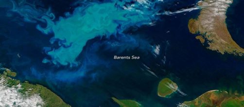
Every year there is an attempt by oceanographers and marine scientists to carry out ecosystem mapping of the Barents Sea, which is located north of Russia and Norway, according to the Barent Observer.
A vast number of marine species are mapped, with important tests on water, sediment, pollution and microplastic all made which provide a huge insight into the health of the ecosystem. This offers vital data for policymakers on where marine life can and cannot be fished, as well as giving an insight into climate change impacts.
Together, both Russian and Norwegian scientists work together to carry out the extensive research.
However, this year, Russian marine researchers were unable to carry out their role in the important scientific process.
This will have a detrimental impact on the scientific study and understanding of the area. The annual ecosystem and Environment mapping of the sea is considered crucial for understanding ongoing major environmental change, as a result of anthropogenic activities and climate change.
Giant gas craters discovered at the bottom of the #BarentsSea, reports @ScienceNordic https://t.co/HUAQxxZEab pic.twitter.com/FwF7umU4Nz
— EGU (@EuroGeosciences) October 9, 2018
Technical problems with research vessel brings a halt to operations
The annual Barents Sea expedition is renowned as one of the world's most comprehensive ocean mapping programs.
The whole of the sea is mapped with hundreds of measurements taken across the area, from the sea floor to the surface and from the coasts to the edge of the northern ice caps.
However, 34-year-old vessel Vilnyus was to blame for the inability of Russian researchers to carry out their ecosystem mapping. The ageing ship experienced a consecutive range of technical problems, including issues with wiring, that resulted in major parts of the Russian's research area not being mapped.
These scientists have found plastic in every area of the Arctic; there are about 225 trillion particles in the whole of the Barents Sea.
— BBC (@BBC) October 1, 2018
Drowning in Plastic | tonight | 8.30pm | @BBCOne https://t.co/34t3gcWgHb pic.twitter.com/FO2CkLrmJA
Huge implications expected for scientific understanding
The scientists will now not have a complete understanding of the area and its ecosystem this year, while there will also be a resulting time gap in the continuing data series.
The huge annual task of ecosystem mapping the Barents Sea started 14 years ago and in that time researchers have seen startlingly rapid changes in the marine environment.
Atle Staalesen wrote for Barent Observer earlier this month and noted that researchers have found that the sea has been rapidly warming over the last decade which could, in turn, have huge impacts on migratory fish species. It is thought that more southern species will now start to move into the area, with previously inhabiting species moving further north in order to finder cooler waters. the Polar Cod has already been proven to show this migratory pattern as a result of the changing conditions.
However, without this year's research and data scientists cannot be sure of the current situation, predict future ecosystem health or make decisions on fishing regulations as a result.
Last year, the mapping findings were vital evidence to allow for the reopening of the catch on Capelin, a species previously near extinction, while the data is also used to determine annual Cod quotas.


